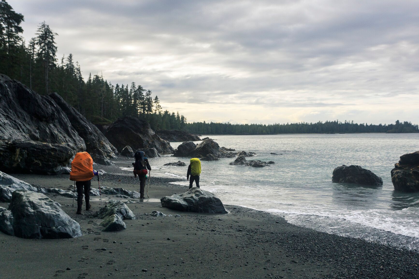
Fisherman's Creek
Mount Waddington · BC
Source: OpenStreetMap — Canadian campsites · imported Aug 17, 2026
Decide fast
Cost
Fee details available
The source publishes fee information but no exact nightly amount — read the published fee notes below.
Fire conditions
Agency fire orders are checked live — open the section for the current stage and what it allows.
Verified check-in
Checking your traveler account…
Only an approximate position is stored, and never shown to other travelers.
The essentials
Key campground facts
Identity-level facts as published by the source record. Fields no source publishes are left out rather than shown as Unknown.
Price
Fee details availableThe source publishes fee information but no exact nightly amount — read the published fee notes below.
Type
Campground
Camping status
Unknown
Land manager
BC Parks
Facility phone
1-844-43K-WILD (5-9453)
Know before you go
No conditions or restrictions are recorded for this location yet. Check the managing agency before you go.
Can you camp here?
Camping legality
Checking land status and camping rules…
Getting there
Access and vehicle suitability
No source publishes road or vehicle information for this location. Road conditions and clearance are never estimated — contact the managing agency before towing or driving in.
Where it is
Location
Loading map
Placing your camping results on the map.
Province / territory
BC
County
Mount Waddington
Elevation
141 ft
Coordinates
50.74826, -128.30473
Straight from the source
Published record details
Statements the source record publishes, shown as published. Anything it does not publish is left out rather than shown as Unknown.
Park size
22300 ha
Year established
1973
Official park name
Cape Scott Park
Park phone
1-844-43K-WILD (5-9453)
Current notices from the source
The Nels Bight and Cape Sutil Ranger Station Cabins will be closed to public access until further notice — Campers must be self-sufficient and prepared to camp at all locations within the park. Thank you for your cooperation.
Pets prohibited except in San Josef Bay area due to wolf activity - pets must be kept on leash in San Josef Bay — BC Parks has received ongoing reports of high wolf activity in some areas of Cape Scott Park. Dogs are only permitted in San Josef Bay area and must be leashed at all times. Dogs are prohibited in all other areas of the park, including the North Coast Trail. Dogs are a high level attractant to wolves and other large carnivores. Protect your pet – keep them at home. All visitors and hikers in Cape Scott must be extremely mindful about how they recreate in coastal wolf habitat to help prevent wolves from becoming habituated to humans and conditioned to attractants. Avoid attracting wolves Securely store your food and cooking equipment during the day and night in food caches provi
Increased bear activity in San Josef Bay — Visitors are advised of increased bear activity within the camping area at San Josef Bay. It is essential that all campers use the bear-proof food caches provided to store food and all attractants while using this site. Hikers are also asked to keep bear spray close and remain vigilant. Report bear sightings and aggressive wildlife to the Conservation Officer Service RAPP line toll-free at 1-877-952-7277 . What to do if you see a bear Learn more about bear safety and backcountry etiquette Stay safe in bear country and help keep bears wild.
Dakota Creek Bridge - closure notice (North Coast Trail) reroute required — The Dakota Creek Bridge on the North Coast Trail (Nahwitti Cone overland section) is currently washed out and unsafe to cross. The bridge is located at approximately 50.79740, -128.262367 . Visitors are advised not to use the existing bridge structure . Crews will be on site this season to establish a temporary reroute on the north side of the Dakota Creek Bridge . This reroute will require fording the creek during high water levels . Anyone travelling in this area should: Be prepared for a creek crossing during high water levels Monitor weather conditions and rainfall forecasts closely Be aware that water levels can rise quickly , and the crossing may become impassable during or after extended rain events Please p
Treat water before use along North Coast Trail — BC Parks is advising all visitors to the North Coast Trail of a potential risk of waterborne illness in natural water sources along the route. Backcountry water sources, including streams, rivers, and lakes, may contain harmful bacteria, parasites, or other pathogens that can cause illness if consumed untreated. Environmental conditions, wildlife activity, and seasonal factors can increase this risk. All water collected from natural sources must be treated before drinking. BC Parks recommends that all hikers plan ahead and carry appropriate, and multiple, water treatment options when traveling on the North Coast Trail.
Campgrounds in this park
- Cape Scott backcountry
Activities the source lists
- Hiking
- Canoeing
- Swimming
- Fishing
- Wildlife viewing
- Hunting
- Winter recreation
- Kayaking
- Pets on leash
Facilities as published
- There are 10 pit toilets available throughout the park. There are no flush toilets at this park.
- The 2.5 km trail to San Josef Bay has been resurfaced with crushed material, and an existing section of the boardwalk has been extended. The trail is barrier-free with some slopes exceeding 8.33%. Accessible parking and an accessible pit toilet are available at the trailhead.
- BC Parks’ boat launch is accessed via San Josef Heritage Park, but it is a BC Parks facility. It is for canoes and kayaks and small car-toppers only. The San Josef River is tidal at this spot so don’t plan on using the launch at low tide or you may be hauling over gravel bars.
- While fires are allowed, we encourage visitors to conserve the environment by minimizing the use of fire and using stoves instead. Two communal fire rings are provided at Eric Lake and three at Nels Bight. Campers are requested to not bury their beach campfires. Several visitors have been burned where fires have been buried. Please practice Leave No Trace camping ethics.
Camping information as published
- Wilderness camping is allowed in this park in areas with limited facilities. No facilities other than food caches (at Guise Bay, Nels Bight, San Josef, Nissen Bight, and Eric Lake) and pit toilets are provided. Please camp on the beach whenever possible. If you erect a temporary shelter, please dismantle it entirely and return the site to its natural state before you leave.
- 5There are 11 designated camp pads located at Eric Lake, available on a first come, first served basis. There is no longer a campsite at Donaldson Farm. Wilderness camping is also allowed in areas with no designated campsites. Reservations and fees Cape Scott Park is open year-round (check website for updates on trail conditions in case areas are closed for safety reasons). Fees are only collected from May 1 to September 30 when backcountry services are provided. Backcountry camp fees Camping fees (per night) $10 per adult (16+) $5 per yourth (6 to 15) Free for childeren under 6 Non-resident fee $20 per adult (16+) per trip within the park You can get a camping permit before leaving home on the backcountry permit registration service . Although the system does not reserve a campsite, the system provides visitors the convenience of prepaying for their trip and not having to carry cash. We encourage all visitors to register online so we can reduce the need to collect fees in the field. Self-registration vaults are located at the San Josef River boat launch and trailhead.
Official maps
Amenities
Only amenities the source actually states are listed. Unknown is never shown as No.
Camping
Only camping types present in the source record.
Setting & surroundings
What's around this campsite
Official park information
Published by the land manager as being at or associated with this place. These are stated facts, not measured distances.
Water
Land & terrain
Source: BC Parks (official park data)
Verified nearby features
Loading verified geographic features…
Activities
Sourced only — activities are never inferred.
Environment and Climate Change Canada
Weather
Forecast for the Fisherman's Creek coordinates. Values ECCC does not publish stay blank rather than being estimated.
Resolving the ECCC forecast for these coordinates…
Staying reachable
Connectivity
Carrier coverage comes from official FCC filings for this coordinate; Starlink information comes from Starlink's own pages. Nothing here is estimated from terrain, land ownership or nearby towns.
Reading stored coverage sources…
Agency fire orders
Fire conditions
Published fire restriction orders from the managing agency, matched to these exact coordinates. Fire permission is never inferred from land ownership, campground type or weather.
Checking agency fire orders for these coordinates…
Nearby services
Fuel, water, dump, supplies and more
Straight-line distance from the campground coordinates. Mapped places only — never inferred.
Looking up mapped services within 25 miles…
Solar
Off-grid power
Will you make enough power to stay comfortably off-grid here? Modelled from published solar climatology for these exact coordinates, credited in the details.
Modelling solar for these coordinates…
Is this place right for you?
Experience & practicality
Two transparent read-time scores. Unknown facts never count for or against a place, and a score is never used as filter evidence.
Experience
Published recreation and setting.
7.2/ 10
Documented depth: 11.5 of 16 evidence weight, from 6 published facts. A low number means little is published, not that the place is poor.
Why
- Hiking
- Fishing
- Kayaking / canoeing
- Swimming
- Wildlife watching
- Hunting
Practicality
Published logistics: access, cost, facilities.
—/ 10
Not enough data. Only 2 relevant facts have been published for this record, so no score is shown rather than an invented one.
Why
- Cost is published
- Pets allowed
Partially supported: only one of the two dimensions has enough published evidence, so this record is not presented or ranked as the equal of a fully documented one.
Methodology nmr-score-3.0.0. Park-level activities feed Experience only; campsite facts feed Practicality only. Experience measures how much recreation and setting evidence is published; Practicality is the published positive share scaled by how much of the logistics catalogue has been documented, so a handful of positives can no longer read 10/10. Unknown is never treated as a no. Neither dimension is used to filter search results, and “Best” ordering ranks fully supported records above partially supported ones.
Overview
Why this place?
- Campground.
- Located in Mount Waddington, BC at 141 ft.
- Source lists 7 recreation activities here.
- Fee details are published, but no exact nightly amount — see the fee notes below.
Photos
What it looks like
Imagery published by the managing source for this record, plus verified traveler photos.
Official imagery
Traveler photos
No traveler photos here yet. A photo you upload is reviewed before it appears publicly.
Community · time-sensitive
Community reports
What travelers found on the ground, with the date they were there. Conditions change fast, and a report never replaces the official information above.
Loading community reports
Data & trust
Source confidence
Low
Confidence describes how well the ingested sources agree for this record. Verification is a separate state: Unverified.
Source
OpenStreetMap — Canadian campsites
Last source update
Aug 18, 2026
Source record
#node/3723057628
Community · traveler experience
Traveler reviews
Written by travelers who checked in here. These are personal experiences, not official campsite information, and they never change the sourced facts above.
Loading traveler reviews
Travelers here
Talk with travelers heading to Fisherman's Creek. Community conversation — not verified site information. Report conditions through the report form so they can be checked.
Nearby and related camping
- Eric LakeMount Waddington · BC · 4 mi away
- Laura Creek CampsiteMount Waddington · BC · 5 mi away
- San Josef Bay CampsiteMount Waddington · BC · 5 mi away
- San Josef Recreation AreaMount Waddington · BC · 5 mi away
- Irony Creek CampsiteMount Waddington · BC · 10 mi away
- Nahwitti River CampsiteMount Waddington · BC · 15 mi away