
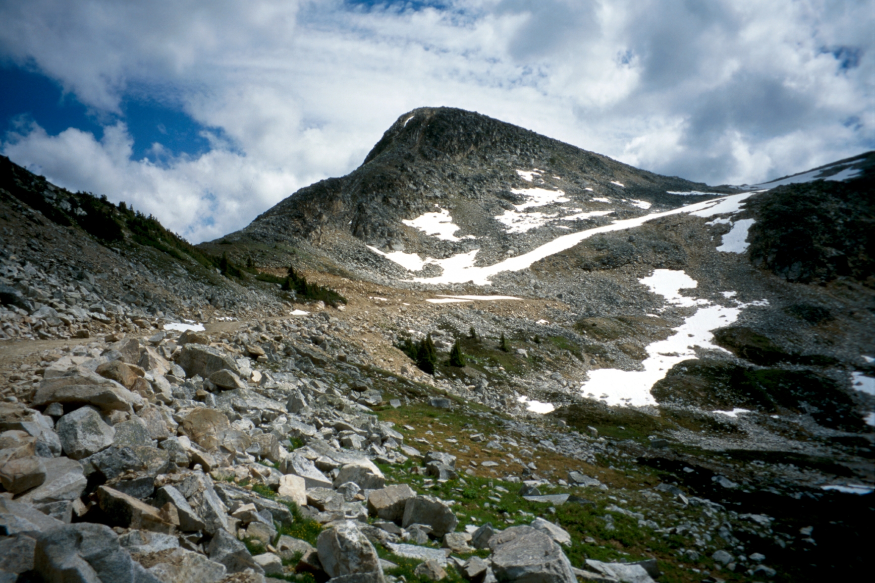
Loop Camp
Thompson-Nicola · BC
Source: BC Parks (official park data) · imported Sep 14, 2026
Decide fast
Fire conditions
Agency fire orders are checked live — open the section for the current stage and what it allows.
Verified check-in
Checking your traveler account…
Only an approximate position is stored, and never shown to other travelers.
The essentials
Key campground facts
Identity-level facts as published by the source record. Fields no source publishes are left out rather than shown as Unknown.
Price
Price not published
Type
Campground
Camping status
Unknown
Land manager
BC Parks
Sites
6 sites (stated by the source)
Reservation
Not required
Know before you go
No conditions or restrictions are recorded for this location yet. Check the managing agency before you go.
Can you camp here?
Camping legality
Checking land status and camping rules…
Getting there
Access and vehicle suitability
Only what the managing agency or Recreation.gov published. Road surface, clearance, grade and seasonal access are never inferred, and fields no source publishes are left out.
Will my vehicle fit?
RV
No
Source: OpenStreetMap — Canadian campsites
Access statements published by OpenStreetMap — Canadian campsites. Conditions change — verify with the managing agency before you rely on them.
Where it is
Location
Loading map
Placing your camping results on the map.
Province / territory
BC
County
Thompson-Nicola
Elevation
810 ft
Coordinates
50.26976, -121.65552
Straight from the source
Published record details
Statements the source record publishes, shown as published. Anything it does not publish is left out rather than shown as Unknown.
Park size
107191 ha
Year established
1995
Official park name
Stein Valley Nlaka'pamux Heritage Park
Current notices from the source
School group information — Visit the Stein Valley Nlaka'pamux Heritage Park: School group information page for more information on how to register in advance of your visit.
Large sections of the Stein Valley trail remain impassable and closed due to the impacts of the 2023 wildfire — In the Lower Valley, beyond Earls Camp, it is impossible to travel further into the park from the west due to many landslides, rockfall events, and hazardous trees. The suspension bridge 12 km from the Lytton trailhead is damaged and closed. The cottonwood cable car has been removed. Due to this, thru-hiking is not possible or advised. There is some access to the park from the Lizzie Lake and Blowdown Pass areas. However, this is only recommended for experienced backcountry users who are aware of all risks and hazards. Hazards in the park may include danger trees (unstable trees that can fall over without warning) and increased tree obstructions on trails, irregular trail surface
Activities the source lists
- Kayaking
- Wildlife viewing
- Hiking
- Pets on leash
- Fishing
- Winter recreation
- Canoeing
- Hunting
Facilities as published
- In the parking area at the trailhead, there are three picnic tables and one pit toilet that is user maintained. There is also a large information shelter depicting the history, landforms and flora and fauna of the park.
- Each campground from the trailhead to Stein Camp has a user maintained pit or backcountry toilet. There is one pit toilet at the trailhead in the parking area. Visitors should bring their own toilet paper. When in the backcountry, please exercise proper backcountry sanitation procedures when no facilities are available. Deposit human waste in cat holes. Cat holes are 15 to 20 cm deep and should be located at least 100 feet from any water source. Thoroughly cover and disguise cat holes when finished. Bury toilet paper as well. Do not burn it.
Camping information as published
- In the lower and mid valleys, there are 11 developed campgrounds. In the lower valley, visitors must camp only at these sites. In the lower valley, from the trailhead near Lytton to Cottonwood Creek, each campground has a pit toilet and a metal food cache. In the mid valley from Scudamore Creek to Stein Camp, each campground has a rustic backcountry toilet and a metal food cache. Visitors must use the food caches provided. The incidence of bear and human conflict has greatly decreased with the use of the food caches. For visitor safety and to lessen the impact on the environment, a metal food cache and backcountry toilet have been installed at Brimful Lake. If you must camp where there is no food cache, use a rope cache, ensuring the food is 4 m off the ground and 1 m from the trunk. In other areas of the park where there are no developed campgrounds. Please camp where your presence will have the least amount of impact on the environment or camp where it is obvious others have camped. Visitors should ensure they are totally self-sufficient . The nearest amenities including pay phone is in Lytton. Due to the low snow levels in the Lytton area, there is opportunity for visitors to camp in the lower valley during the winter.
- Large groups (over four) need to contact the Thompson Southern Rivers staff of the BC Parks office in Kamloops during the planning phase for the Stein. Please do not go until you coordinate with the BC Parks staff. This park has a limited carrying capacity (i.e. limited resources in small areas) and we need to minimize negative impacts to the environment and other backcountry campers. These campgrounds are set up to accommodate larger groups: Devil’s Staircase Teepee Suspension Bridge Cottonwood Creek Please use the ‘Contact Us’ link on the webpage or call 250-371-6200 to discuss the Stein with the Thompson Southern Rivers staff with BC Parks. School Group Information The following table provides recommendations regarding group sizes: East-West traverse (main trailhead to Tundra Lake) # Campground # of tent pads Max # of people (for entire campground) Approx GPS location Other info 1 Loop See ‘other information’ 16 50° 16’ 11.82"; -121° 39’ 21.78" Improved in summer 2017. Can accommodate at least 6 (single) tents. 2 Devil’s Staircase See ‘other information’ 16 50° 15’ 54.48"; -121° 40’ 58.20" Improved in summer 2017. Can accommodate at least 6 (single) tents. 3 Teepee See ‘other information’ 16 50° 16’ 16.02"; -121° 43’ 46.14" Improved in summer 2017. Can accommodate at least 6 (single) tents. 4 Earl’s See ‘other information’ 16 50° 16’ 53.04"; -121° 45’ 11.82" Improved in summer 2017. Can accommodate at least 6 (single) tents. 5 Suspension Bridge See ‘other information’ 20 (approx) 50° 17’ 25.92"; -121° 46’ 54.24" Improved in 2016-2017. Largest campground in the park. Please stay in open areas of campground. 6 Lean-to 3 8 50° 18’ 20.88"; -121° 49’ 30.00" Improved in 2016. 7 Ponderosa 3 8 50° 18’ 39.18"; -121° 52’ 12.12" Improved in 2016. 8 Cottonwood 3 12 50° 18’ 21.60"; --121° 57’ 32.40" Improved in 2016. 9 Logjam 3 8 50° 15’ 54.00"; -122° 0’ 34.26" Improved in 2016. 10 Avalanche 3 8 50° 12’34.18"; -122° 4’38.94 Improved in 2016. 11 Stein Lake 3 8 50° 10’ 1.92"; -
- Due to the low snow levels in the Lytton area, there is opportunity for visitors to camp in the lower valley during the winter.
Official maps
Amenities
Only amenities the source actually states are listed. Unknown is never shown as No.
Camping
Only camping types present in the source record.
Setting & surroundings
What's around this campsite
Official park information
Published by the land manager as being at or associated with this place. These are stated facts, not measured distances.
Water
Land & terrain
Source: BC Parks (official park data)
Verified nearby features
Loading verified geographic features…
Activities
Sourced only — activities are never inferred.
Environment and Climate Change Canada
Weather
Forecast for the Loop Camp coordinates. Values ECCC does not publish stay blank rather than being estimated.
Resolving the ECCC forecast for these coordinates…
Staying reachable
Connectivity
Carrier coverage comes from official FCC filings for this coordinate; Starlink information comes from Starlink's own pages. Nothing here is estimated from terrain, land ownership or nearby towns.
Reading stored coverage sources…
Agency fire orders
Fire conditions
Published fire restriction orders from the managing agency, matched to these exact coordinates. Fire permission is never inferred from land ownership, campground type or weather.
Checking agency fire orders for these coordinates…
Nearby services
Fuel, water, dump, supplies and more
Straight-line distance from the campground coordinates. Mapped places only — never inferred.
Looking up mapped services within 25 miles…
Solar
Off-grid power
Will you make enough power to stay comfortably off-grid here? Modelled from published solar climatology for these exact coordinates, credited in the details.
Modelling solar for these coordinates…
Is this place right for you?
Experience & practicality
Two transparent read-time scores. Unknown facts never count for or against a place, and a score is never used as filter evidence.
Experience
Published recreation and setting.
5.9/ 10
Documented depth: 9.5 of 16 evidence weight, from 5 published facts. A low number means little is published, not that the place is poor.
Why
- Hiking
- Fishing
- Kayaking / canoeing
- Wildlife watching
- Hunting
Practicality
Published logistics: access, cost, facilities.
2.8/ 10
56% of the 6 published facts are positive, scaled by how much is documented (50% of the 16-weight target). Thin data coverage · 21 still unpublished. A thin record reads low because little is published, not because the place is poor.
Why
- Restroom
- No reservation required
- Pets allowed
Published as not available
- RV friendly
- Fire ring
- Shower
Fully supported: both dimensions earned a score from 11 published facts.
Methodology nmr-score-3.0.0. Park-level activities feed Experience only; campsite facts feed Practicality only. Experience measures how much recreation and setting evidence is published; Practicality is the published positive share scaled by how much of the logistics catalogue has been documented, so a handful of positives can no longer read 10/10. Unknown is never treated as a no. Neither dimension is used to filter search results, and “Best” ordering ranks fully supported records above partially supported ones.
Overview
Why this place?
- Campground.
- Located in Thompson-Nicola, BC at 810 ft.
- Source lists 6 recreation activities here.
- No source publishes pricing for this location, so cost is unknown.
Photos
What it looks like
Imagery published by the managing source for this record, plus verified traveler photos.
Official imagery
Traveler photos
No traveler photos here yet. A photo you upload is reviewed before it appears publicly.
Community · time-sensitive
Community reports
What travelers found on the ground, with the date they were there. Conditions change fast, and a report never replaces the official information above.
Loading community reports
Data & trust
Source confidence
Low
Confidence describes how well the ingested sources agree for this record. Verification is a separate state: Unverified.
Source
BC Parks (official park data)
Last source update
Sep 14, 2026
Source record
#bc-park:stein-valley-nlakapamux-heritage-park:e931890d-c01c-4783-b3fd-3508bf364418
Community · traveler experience
Traveler reviews
Written by travelers who checked in here. These are personal experiences, not official campsite information, and they never change the sourced facts above.
Loading traveler reviews
Travelers here
Talk with travelers heading to Loop Camp. Community conversation — not verified site information. Report conditions through the report form so they can be checked.