
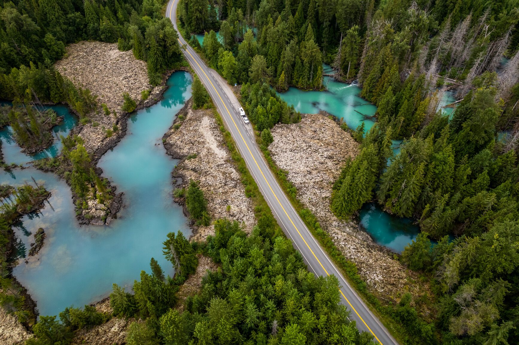
Vetter Creek Campground
Kitimat-Stikine · BC
Source: OpenStreetMap — Canadian campsites · imported Aug 18, 2026
Decide fast
Fire conditions
Agency fire orders are checked live — open the section for the current stage and what it allows.
Verified check-in
Checking your traveler account…
Only an approximate position is stored, and never shown to other travelers.
The essentials
Key campground facts
Identity-level facts as published by the source record. Fields no source publishes are left out rather than shown as Unknown.
Price
Price not published
Type
Campground
Camping status
Unknown
Land manager
BC Parks
Sites
16 sites (stated by the source)
Know before you go
No conditions or restrictions are recorded for this location yet. Check the managing agency before you go.
Can you camp here?
Camping legality
Checking land status and camping rules…
Getting there
Access and vehicle suitability
Only what the managing agency or Recreation.gov published. Road surface, clearance, grade and seasonal access are never inferred, and fields no source publishes are left out.
Will my vehicle fit?
RV
Yes
Source: OpenStreetMap — Canadian campsites
Access statements published by OpenStreetMap — Canadian campsites. Conditions change — verify with the managing agency before you rely on them.
Where it is
Location
Loading map
Placing your camping results on the map.
Province / territory
BC
County
Kitimat-Stikine
Elevation
180 ft
Coordinates
55.19565, -129.11624
Straight from the source
Published record details
Statements the source record publishes, shown as published. Anything it does not publish is left out rather than shown as Unknown.
Campsites stated by the park
16 sites
Park size
17717 ha
Year established
1992
Official park name
Anhluut'ukwsim Lax̱mihl Angwinga'asanskwhl Nisg̱a'a Park [a.k.a. Nisg̱a'a Memorial Lava Bed Park]
Current notices from the source
Lava Cone tour offerings, 2026 season — The remaining 2026 tour dates and times are: August 26, 10 am to 2:30 pm September 2, 10 am to 2:30 pm Register or book a private tour by emailing parkoperator@katcforestry.ca to reerve your spot.
Bear safe food storage lockers available — Available for use by cyclists, motorcyclists, and anyone without bear-proof storage for wildlife attractants. Located in the campground between sites 1 and 2. Users are asked to tidy their locker as needed.
Nisga'a Campground Carving Shed open to visitors — Beginning July 24 to the end of September, visitors are welcome on Fridays, Saturdays and Sundays from 12 pm to 3 pm, to join Patrick – a resident artist with BC Parks and the Nisga'a Nation, as Patrick brings traditional Northwest Coast carving to life at the Nass Valley Carving Shed. Visitors are welcome to watch him work, ask questions, and connect with living Nisga'a culture and artistic tradition. Patrick is a Nisga'a artist of the Ganada (Raven) clan, working from the traditional territory his people have called home for generations. He holds a degree in First Nations Studies and Health Sciences, and a two-year Fine Arts diploma from the Freda Diesing School of Northwest Coast Art — one of BC's most respected Indigenous art training
Campgrounds in this park
- Vetter Creek Campground
Activities the source lists
- Hiking
- Interpretive programs
- Swimming
- Canoeing
- Kayaking
- Fishing
- Wildlife viewing
- Cycling
- Pets on leash
- Hunting
- Winter recreation
Facilities as published
- Hlgu Isgwit (Nass Valley or Nisg̱a’a) Hot Springs The hot springs are not within the park boundaries. To visit, contact the Nisg̱a’a Lisims Government at 250-633-3000 or visit nisgaanation.ca . Please be respectful when visiting. The area is a sacred place and must be treated with respect. Thank you for your cooperation.
- Nisg̱a’a Visitor Centre The Nisga’a Visitor Centre is located at the campground and offers merchandise, maps, stories, pictures, and information about attractions. Learn about Nisg̱a’a language, culture, history, feasts, and laws. Hours of operation: May 15 to June 29 Friday, Saturday, Sunday 10 am to 5pm June 30 to August 31 Tuesday, Wednesday, Thursday 10 am to 5 pm Friday, Saturday, Sunday 10 am to 6 pm Closed Monday September 1 to September 15 Friday, Saturday, Sunday 10 am to 5 pm Statutory holidays (except Labour Day) Closed
- Accessibility information is available for these areas of the park: 10 auto tour stops Campground Visitor Centre
- Day-use and picnic areas are located at Vetter Falls, Lava Lake, and at the Visitor Centre. There are fire rings and picnic tables available at the Nisga’a Visitor Centre and the Lava Lake day-use area.
- Pit toilets are available at Lava Lake, Vetter Falls campground, Vetter Falls trail, the Nisga’a Visitor Centre , and the Tseax River pullout. A wheelchair-accessible pit toilet is located at Vetter Falls campground.
- There is a groundwater hand pump at the campground. The water is tested monthly, but is under a permanent boil water advisory.
- To access the Nass River, a single lane, gravel boat launch can be found at the park’s north end. Overnight moorage is not recommended here due to fluctuating river levels. To access Lava Lake, a single lane, gravel boat launch can be found at the park’s south end. Parking space is available for vehicle and boat trailers at both locations. For boat launch locations, see maps and location .
- We encourage visitors to conserve wood and use camp stoves instead of fires. Fire rings are available at the Lava Lake day use area, the visitor centre, and at each campsite. Firewood is available to purchase at the campground. Campfires are allowed in the backcountry. However, you should always follow Leave No Trace outdoor ethics. Campfires are prohibited on the lava beds. To preserve plants and ground cover, do not gather firewood in the park. This is an offence under the Park Act . Dead wood is important habitat for plants and animals, and it adds valuable organic material to the soil.
Camping information as published
- Wilderness camping is permitted in the backcountry and alpine areas, but there are no developed trails to access these areas. Wilderness camping is not permitted on the lava beds or in the frontcountry. For a park map, see maps and location .
- Vetter Creek The campground offers 16 vehicle-accessible campsites on a first come, first served basis. Campsite reservations are not accepted. Large sites for RVs, double sites, and wheelchair-accessible sites are available. Most sites are shaded by the surrounding deciduous forest. Additional parking is available at the Nisga’a Visitor Centre next to the campground. Self-registration, running water, and firewood are available. There are no sani-dump facilities. For a park map, see maps and location . Frontcountry camping fees (per party) Peak season rate $20 per night Shoulder season rate $20 per night $10 per night (B.C. seniors' rate) Non-resident fee $20 per stay
Official maps
Amenities
Only amenities the source actually states are listed. Unknown is never shown as No.
Camping
Only camping types present in the source record.
Setting & surroundings
What's around this campsite
Official park information
Published by the land manager as being at or associated with this place. These are stated facts, not measured distances.
Water
Land & terrain
Source: BC Parks (official park data)
Verified nearby features
Loading verified geographic features…
Activities
Sourced only — activities are never inferred.
Environment and Climate Change Canada
Weather
Forecast for the Vetter Creek Campground coordinates. Values ECCC does not publish stay blank rather than being estimated.
Resolving the ECCC forecast for these coordinates…
Staying reachable
Connectivity
Carrier coverage comes from official FCC filings for this coordinate; Starlink information comes from Starlink's own pages. Nothing here is estimated from terrain, land ownership or nearby towns.
Reading stored coverage sources…
Agency fire orders
Fire conditions
Published fire restriction orders from the managing agency, matched to these exact coordinates. Fire permission is never inferred from land ownership, campground type or weather.
Checking agency fire orders for these coordinates…
Nearby services
Fuel, water, dump, supplies and more
Straight-line distance from the campground coordinates. Mapped places only — never inferred.
Looking up mapped services within 25 miles…
Solar
Off-grid power
Will you make enough power to stay comfortably off-grid here? Modelled from published solar climatology for these exact coordinates, credited in the details.
Modelling solar for these coordinates…
Is this place right for you?
Experience & practicality
Two transparent read-time scores. Unknown facts never count for or against a place, and a score is never used as filter evidence.
Experience
Published recreation and setting.
7.2/ 10
Documented depth: 11.5 of 16 evidence weight, from 6 published facts. A low number means little is published, not that the place is poor.
Why
- Hiking
- Fishing
- Kayaking / canoeing
- Swimming
- Wildlife watching
- Hunting
Practicality
Published logistics: access, cost, facilities.
3.8/ 10
100% of the 4 published facts are positive, scaled by how much is documented (38% of the 16-weight target). Thin data coverage · 23 still unpublished. A thin record reads low because little is published, not because the place is poor.
Why
- Drinking water
- Cost is published
- RV friendly
- Pets allowed
Fully supported: both dimensions earned a score from 10 published facts.
Methodology nmr-score-3.0.0. Park-level activities feed Experience only; campsite facts feed Practicality only. Experience measures how much recreation and setting evidence is published; Practicality is the published positive share scaled by how much of the logistics catalogue has been documented, so a handful of positives can no longer read 10/10. Unknown is never treated as a no. Neither dimension is used to filter search results, and “Best” ordering ranks fully supported records above partially supported ones.
Overview
Why this place?
- Campground.
- Located in Kitimat-Stikine, BC at 180 ft.
- Source lists 8 recreation activities here.
- No source publishes pricing for this location, so cost is unknown.
Photos
What it looks like
Imagery published by the managing source for this record, plus verified traveler photos.
Official imagery
Traveler photos
No traveler photos here yet. A photo you upload is reviewed before it appears publicly.
Community · time-sensitive
Community reports
What travelers found on the ground, with the date they were there. Conditions change fast, and a report never replaces the official information above.
Loading community reports
Data & trust
Source confidence
Low
Confidence describes how well the ingested sources agree for this record. Verification is a separate state: Unverified.
Source
OpenStreetMap — Canadian campsites
Last source update
Aug 18, 2026
Source record
#way/1370739514
Community · traveler experience
Traveler reviews
Written by travelers who checked in here. These are personal experiences, not official campsite information, and they never change the sourced facts above.
Loading traveler reviews
Travelers here
Talk with travelers heading to Vetter Creek Campground. Community conversation — not verified site information. Report conditions through the report form so they can be checked.
Nearby and related camping
- Bonus Lake Recreation SiteKitimat-Stikine · BC · 35 mi away
- Hart FarmKitimat-Stikine · BC · 35 mi away
- RED SAND LAKEKitimat-Stikine · BC · 36 mi away
- Derrick Lake (Steward) Recreation SiteKitimat-Stikine · BC · 36 mi away
- Kitwanga River RV CampgroundKitimat-Stikine · BC · 43 mi away
- PINE LAKE (2 SITES)Kitimat-Stikine · BC · 44 mi away